


 |
|
Our Pictures of Hikes in the
San Juan National Forest - Pagosa Springs - 2010
Our Pictures of Hikes in the
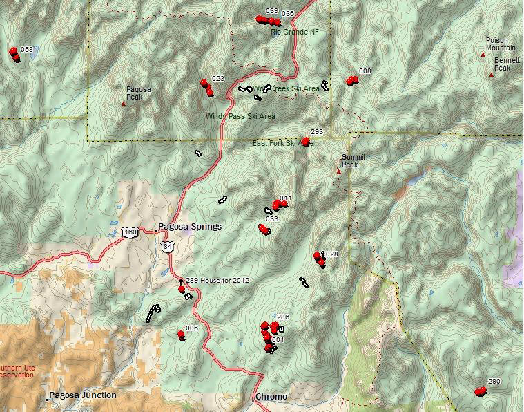
San Juan National Forest - Pagosa Springs - 2012
Our Pictures of Hikes in the
San Juan National Forest - Pagosa Springs - 2013 - Mainly West Fork fire
After several years of
primarily hiking the front range we decided it was time for a change. Ultimately
we choose Pagosa Springs, Colorado. Pagosa is great hiking country. The town is
in a bowl surrounded on all sides by mountains. This affords easy access to the
trails and the back country. For you hardy types, the Continental Divide trail
runs around the "bowl" on the mountains ranges to the east and to the north.
Through the years we have ended up doing most of our hiking to date in the
mountains to the east of town. This would involve the national forest off of
highway 160 going up to Wolf Creek pass, and the mountains off of highway 84
leading south out of town. There tends to be more people on the trails around
160, but you can drive miles back into the woods on the east of highway 160 and
get as far back into the forest as you like. The mountains off of 160 and 84
both have lots of streams and creeks that stay running in the summer, which is
always nice when you're hiking with dogs. The mountains to the south and to the
west tend to be drier.
The hikes are numerous, with any level of difficultly you like. We've been
hiking here for three years and we can still hike new trails on a daily basis if
we choose to. With just a little effort, you will rarely see another person.
Wildlife abounds everywhere. We have stumbled across fox, bear, more bear, deer,
turkey, and eagles (lots of eagles in the area), just to name a few. Surprising
enough no elk or large cats yet. On the ground we have found arrowheads, musket
balls, carnelian, and rocks with flakes of gold (not uncommon for southern
Colorado - so don't start packing your bags :-) ). The flowers are great, the
mushrooms are appropriately weird looking.
Anyway. to get to the point, this is flat out some of the best hiking we have
found in Colorado for the way we like to hike. Well worth the time it might take
to get here. It's possible that one of the reasons the hiking is great is that
Pagosa is not on the way to anywhere large, and is not close to a big city.
While technically not Pagosa Springs, it's probably worth mentioning that
highway 17 north out of Chama, New Mexico is worth the drive. Its about 45
minutes to Chama. There is also a steam train there that goes up highway 17 (it
doesn't follow the highway all the way over the passes, but swings off to the
east at some point). Nice drive all around. We haven't had a chance to do much
hiking in the area yet, but it looks promising.
.jpg)
Pagosa Area Trail
Fall 2012 |